Heatwave record for Pacific North West
29 Jun 2021 03:29 PM
A record-breaking heatwave is devastating parts of northwestern North America, and the heat is expected to continue now through much of this week.
Temperatures in parts of the northwest USA and southwest Canada are likely to reach as high as around 45.0°C by day for perhaps five or more days, with extremely warm nights in between.
In the affected area a few thunderstorms and locally gusty winds will bring wildfire risks.
Paul Hutcheon is a meteorologist with the Met Office’s global guidance unit. He yesterday said:
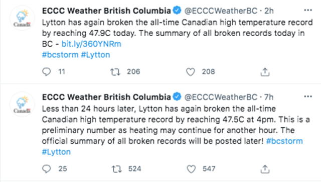
“Many all-time long-standing station records are expected to be broken for many days in a row, some by more than 5.0°C. The all-time Canadian record was broken on Sunday, with Lytton in British Columbia recording 46.6°C (1.6°C higher than the previous record set on 5 July 1937). Less than 24 hours later, Lytton broke this record again, reaching 47.9°C on Monday To put this into context the average June maximum is around 24.3°C.”
Armel Castellan is a meteorologist with Environment and Climate Change Canada. He yesterday said:
“Higher temperatures started in earnest on Friday and it will be peaking early this week for the coast and the middle of the week for the interior of British Columbia, and then the heat will be moving east into Alberta: so we are not done with this yet.
“Yukon and Northwest Territories have recorded their all-time highest temperatures not just in June, but any point in the year. We are setting records that have no business in being set so early in the season.”
The heat is also affecting northwestern United States with Seattle setting a new all-time record at 40°C and this is expected to be exceeded on Monday with 44.0°C. Portland, in Oregon, broke the record twice: 42.0°C on Saturday and 44.4°C on Sunday, according to the US National Weather Service.
During the week, the central focus of the heat dome shifts gradually eastwards away from British Columbia and into Alberta
The heat is being driven by a huge ridge of high pressure. Armel Castellan yesterday explained:
“We have experienced a ridge with low pressure sandwiched on either side. And it’s really hard to move it. The jet stream isn’t moving it along. In that pattern we have essentially a heat dome. A pattern that is sticking to its guns where pollutants and heat keep adding to each other. It is compounding.
“The first day of a ridge like this is warm and we are very close to the solstice so we are dealing with the highest sun angle in the sky, and we have had many days of this in a row and each morning we wake up to a higher temperatures. This is what is dangerous and it is affecting people throughout many days where they are dehydrated and we have had many days where the temperature is higher than the day before.
“Overnight lows being higher than our average daytime highs for late June is a really big deal. Our bodies need to cool off and recover before taking on another day of high temperatures. Another thing to think about is the infrastructure. Fewer than 40 per cent of homes have air conditioning on the coast, people are having to go to libraries and shopping malls to find a couple of hours of air conditioning. I have been sleeping in a tent to get some respite from the heat.”

Even at night residents of British Columbia, including here in Vancouver, have been struggling to cope with the extreme night-time heat. Picture: Shutterstock.
The impacts from the record-breaking heat are expected to be significant. Paul Hutcheon of the Met Office added:
“Significant excess human and animal mortality is likely. In this region properties are generally designed to retain heat, not to shed heat, and air conditioning is much less prevalent than in other parts of North America. These temperatures will also likely stress infrastructure in this region, for example, power and water supplies. Additionally the risk of wildfires will increase throughout this spell. The warmth may well lead to rapid melting of the some mountain snowpack across the region, which could lead to some localised avalanche, flooding, and landslides in the mountains.”
Commenting specifically on the threat of wildfire, Armel Castellan concluded:
“Unfortunately the outlook is very dry, we have some thunderstorm activity that will bring some respite but It is very dangerous to add dry lightning to a very strong drought signal: we are very susceptible to a wildfire event transpiring.”
Climate change
In a statement, the World Meteorological Organization yesterday said:
“These early summer hot weather conditions are taking place against the background of human-induced climate change with global temperatures already 1.2 C higher than pre-industrial levels.
“Heatwaves are becoming more frequent and intense as greenhouse gas concentrations lead to a rise in global temperatures. They are starting earlier and ending later and are taking an increasing toll on human health and health systems.”
Other parts of the northern hemisphere are already experiencing exceptional early hot summer conditions extending from north Africa, the Arabian Peninsula, eastern Europe, Iran and the north-western Indian continent, with maximum daily temperatures exceeding 45.0°C in several locations and reaching 50.0 C in the Sahara. Western Russia and areas around the Caspian Sea have also seen unusually high temperatures due to the continued presence of a large area of high pressure. In parts of the region including Moscow temperatures have been reaching the mid-30s°C by day, remaining above 20°C by night. Areas nearer the Caspian Sea are expected to experience temperatures reaching the mid 40s°C and remaining above 25°C at night. It is likely that some all-time temperature records will be set during this heatwave.
Nikos Christidis is a climate scientist with the Met Office. He yesterday said:
“Without human-induced climate change, it would have been almost impossible to hit such record-breaking mean June temperatures in the Western United States as the chances of natural occurrence is once every tens of thousands of years.
“In the present-day climate getting an extremely hot June is common and is likely to occur twice in three decades. However, an analysis from many computer models suggests that by the end of the century these extreme temperatures are more likely than not. Human influence is estimated to have increased the likelihood of a new record several thousand times.”