

back to listings SME Profile: Remote Sensing Applications Consultants Ltd

Little Barn, Sutton Manor, Bishop's Sutton, Alresford, Hampshire, SO24 0AA
Telephone: +44 (0)1962 736150 e: consultants@rsacl.co.uk w: rsacl.co.uk
Remote Sensing Applications Consultants Limited offers technical expertise in satellite image processing and analysis and associated product and systems development, as well as project management capabilities, for the research and development of novel Earth Observation applications, primarily in the fields of agriculture and forestry. We have been working with a range of public and private clients around the world for more than 30 years.
RSAC Ltd competencies encompass:
- In-depth experience of a range of optical and radar satellite imagery, as well as aerial photography and UAV survey;
- All aspects of satellite data processing in off-line and/or cloud-based environments;
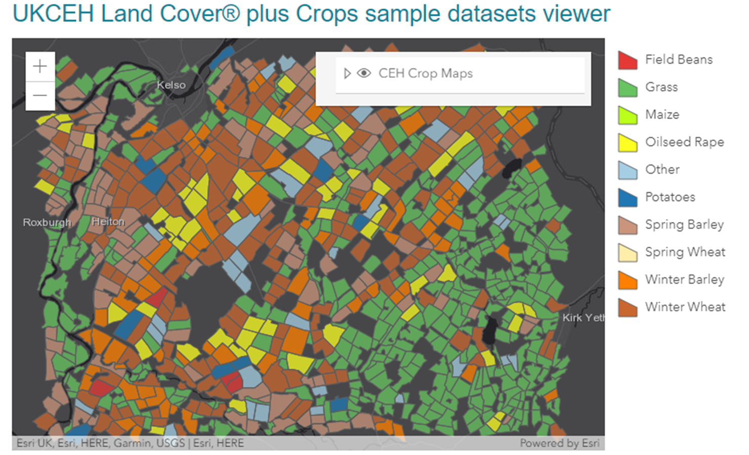
- Classification or discrimination of common crops within mapped agricultural parcels based on detailed analysis of satellite data time series;
- Land cover mapping and land cover change monitoring (including forest disturbance) using satellite data;
- Development of novel satellite-derived metrics for the observation of crop growth, crop condition and other agricultural phenomena;
- Ground data collection for training and validation of satellite-derived products, particularly relating to agricultural crops;
- Development of systems for the generation of satellite-derived mapping and monitoring products suitable for adoption and operation by non-specialised staff in diverse user organisations;
- Provision of training on remote sensing technologies, techniques and applications;
- Project management and leadership (for which recognition of excellence has been received in numerous cases);
- A long history of providing scientific, technical and secretarial support to various groups.
UKCEH Land Cover® plus: Crops
In collaboration with the UK Centre for Ecology and Hydrology (UKCEH), RSAC produces UKCEH Land Cover® plus Crops, an annual agricultural land cover layer derived from Copernicus Sentinel radar and optical data for the whole of Great Britain.
Crop Map Explorer
A newly developed online platform enabling visualisation and analysis of the information contained in the archive of UKCEH Land Cover® plus Crop maps since 2017, including cropping history and rotations, as well as per parcel data on annual winter vegetation cover and topography. Geographical summary is available by river catchments or administrative areas.

.gif)